|
Summer Mathematics Adventure #7 – Orienteering
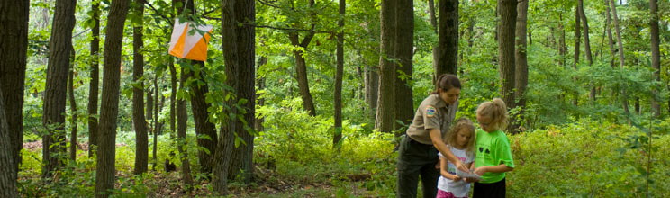
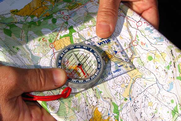
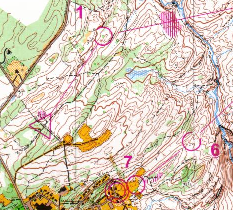
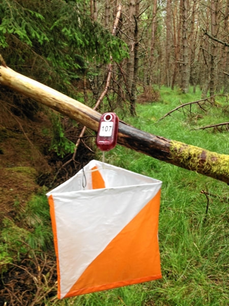
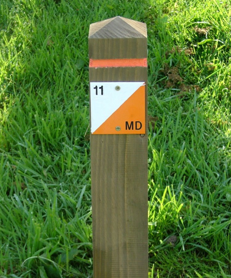
Have you ever gone orienteering? Orienteering is a recreational, outdoor adventure that involves finding a set of points in a landscape using an accurate, detailed map and a compass. It can be approached as a fun walk in the woods or as a competitive sport in which speed of course navigation is the objective. Navigating Using a Map and Compass. Maps are scaled-down representations of the real world, so navigating the real world via a map is inherently mathematical. Orienteering maps are incredibly detailed and include things like fences, boulders, lone trees, vegetation boundaries, buildings, and so on. In addition, there is a detailed legend on each map and an international code for the symbols. For the map to be useful, you need to orient the map – that is, the map needs to be positioned so that north on the map points to north on the earth. If you have a good sense of direction and you know, more or less, which direction is north, this is usually good enough for orienteering purposes. Little kids typically don’t have such a great sense of direction – and compasses are cool – so it’s fun to bring one along and give it a whirl so your kid can help with navigating. See Compass Dude’s website for the lowdown on map and compass. Orienteering Events. The Bay Area Orienteering Club is the main mover and shaker for local orienteering events. They sponsor, set up, and oversee numerous local orienteering events throughout the year, many of which include beginner clinics and multiple levels of courses to traverse. You can see their schedule of events on their website www.baoc.org. You can either race competitively or walk leisurely through a course at an orienteering event. The earliest BAOC-sponsored events suitable for families will be in the fall, but you don’t have to wait for an event to go orienteering. Permanent Orienteering Courses at Vasona Park. There are three permanent orienteering courses set up at Vasona Park - a white course for beginners, a yellow course for advanced beginners, and an orange (intermediate) course. Last week, I took my older daughter to Vasona Park to try out the white course. Starting and ending at the playground, we navigated our way to five different places on the map, finding the designated marker at all stops except the third one. (These courses were set up in 2012, and some things have changed in the park since then – the marker at this third spot was supposed to be on a fence, but the fence now there is clearly newish, so it appears that the marker did not get transferred to the new fence.) I have not tried the yellow or orange courses, so it is possible that those courses also are missing a marker or two. If you want to give one of these Vasona courses a go, see the Permanent Courses page on the Bay Area Orienteering website and scroll to the bottom to download and print maps. Logistics of Orienteering. A standard orienteering course has a start location (marked by a triangle on the map), a series of stops (called control sites, marked by numbered circles on the map), and a finish location (marked by a double circle on the map). For each control site, the circle on the map is centered on the feature to be found and the legend gives you clues about where to look. There is a marker at each control site. For orienteering events, the marker is a white and orange flag and to verify that you found that control marker, you’ll either punch a race card using the hole punch attached to the flag pole (there’s a different hole punch at each control), or you’ll punch an electronic “finger stick” into an e-reader attached to the flag pole. For permanent orienteering courses, the marker is a small (about 4 inches by 4 inches) square white and orange sign, usually affixed to some permanent structure or feature, and to verify that you found that control marker, you’ll write down the letter that is on the sign. The path from one control site to the next is up to you! The elements of choice, decision making, trying, backtracking, and trying again that are involved in navigating the route are the essence of orienteering and also where the most intense mathematical thinking and problem solving happens. The youngest kids can carry the map and compass, point to which direction is north, help orient the map, and point in the direction of where to go next. Slightly older kids can carry the summary sheet of the international control description symbols, help decode the legend, and be timekeepers. Still older kids can be the lead map readers, help identify landmarks, estimate actual distances from map distances, and strategize the navigation. Much older kids – those with tech-savvy skills – can learn how to make an orienteering map! See the website Junior Mapper’s Guide for an introduction. When you consider the primary skills in orienteering – knowing where you are, knowing where you want to go, and charting and navigating a path from here to there – it’s easy to see how applicable this is to real life. Here’s to successful orienteering adventures. |
